Portland Parks & Recreation: Field Trip Activity Guides for School Programming
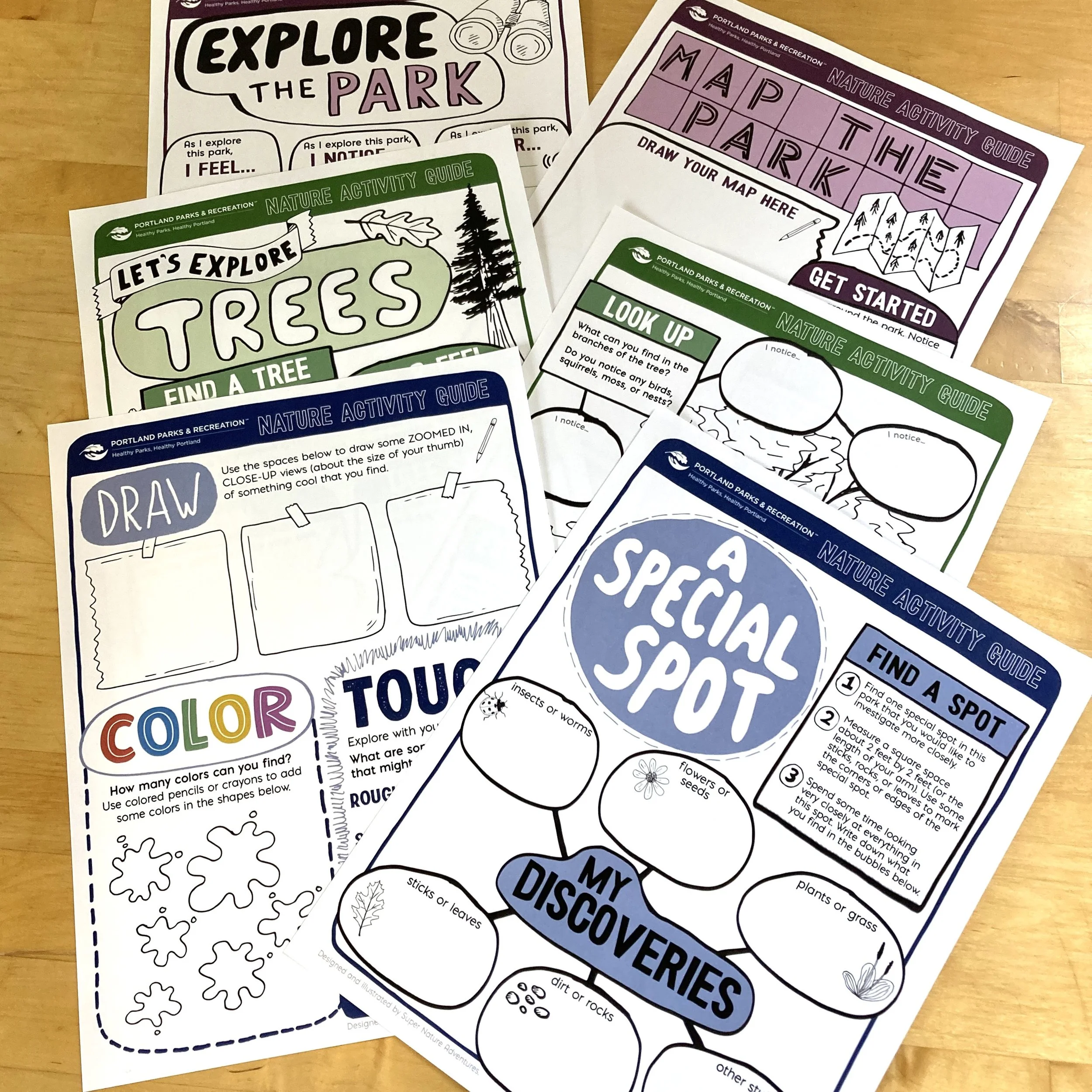
The Portland Parks & Recreation Nature Activity Guides are a set of three double-sided, place-based activity sheets that we developed with Children & Family Programs at Portland Parks & Recreation for use with 2nd and 3rd grade students at Portland area Title I Schools.
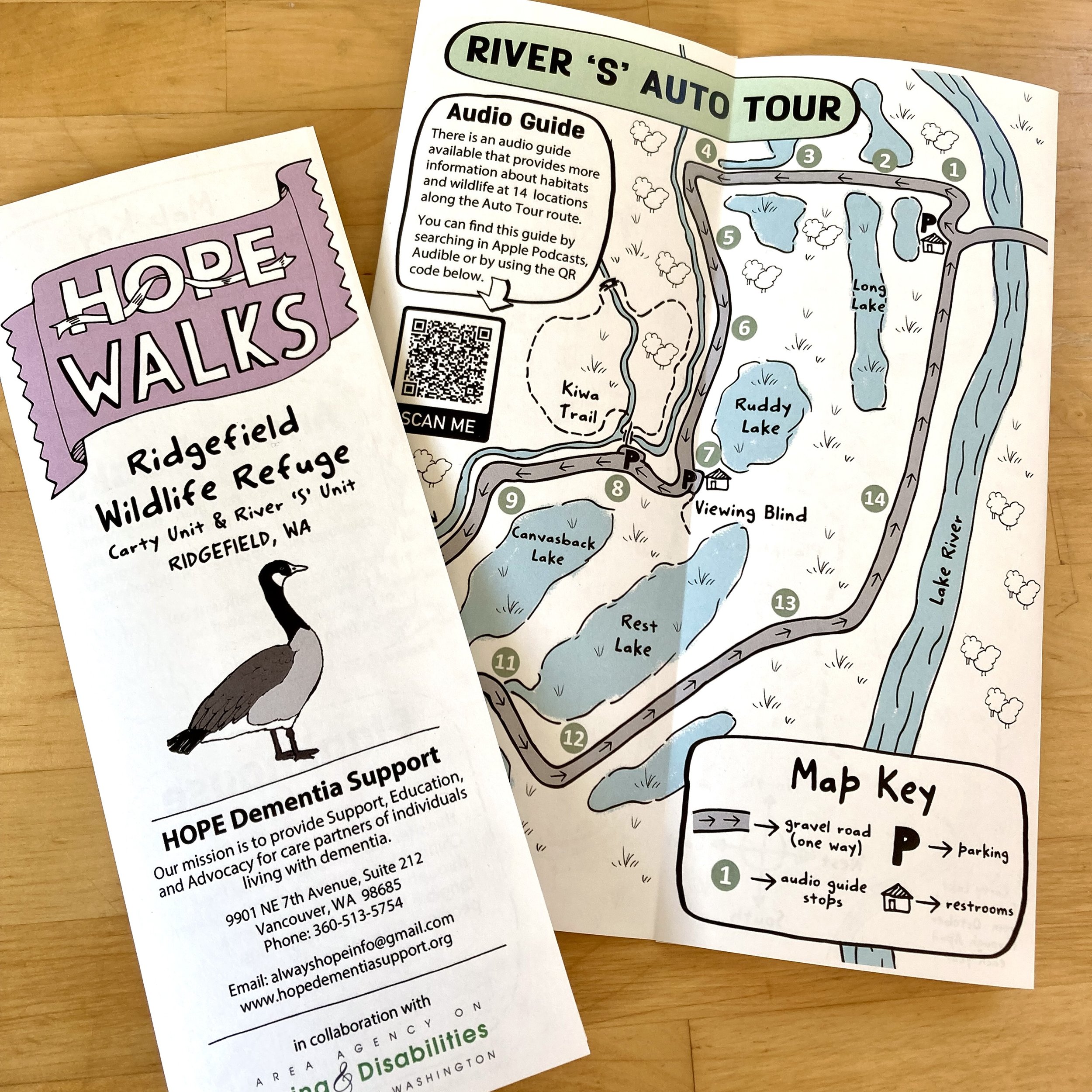
HOPE Walks Trail Maps: Ridgefield National Wildlife Refuge
Learn more about the Ridgefield National Wildlife Refuge Map, part of the HOPE Walks Trail Maps series, a set of maps commissioned by Hope Dementia Support in partnership with the Area Agency on Aging & Disabilities of Southwest Washington for public use, with a special focus on aging populations, including those with dementia and those who care for them.
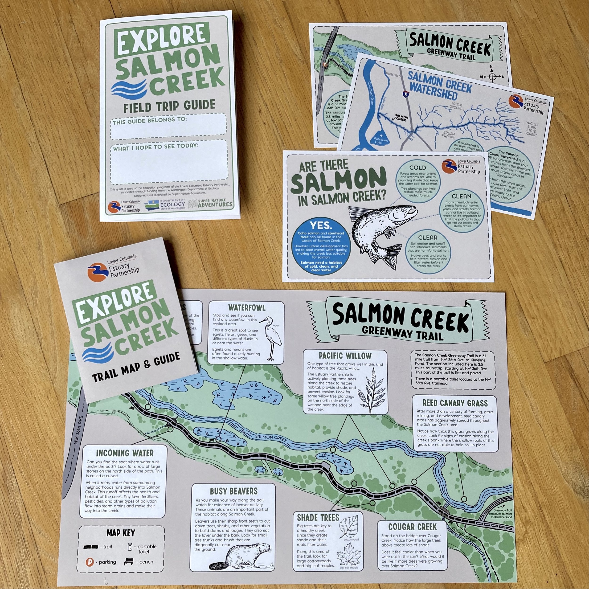
Explore Salmon Creek Project
The “Explore Salmon Creek” project was commissioned by the Lower Columbia Estuary Partnership, a Vancouver, Washington, based non-profit organization dedicated to protecting the Columbia River basin and educating the community, as part of the educational and volunteer programs there. This material focuses on themes of stewardship and environmental protection.

Portland Parks & Recreation: Summer Nature Camp Staff Park Maps
In the summer of 2021, we were hired by Portland Parks & Recreation’s Environmental Education Department to design a series of staff maps for four of their summer nature camp locations. These maps were designed as an important resource as the summer camp program returned after a year of absence during the first phase of the COVID19 pandemic.
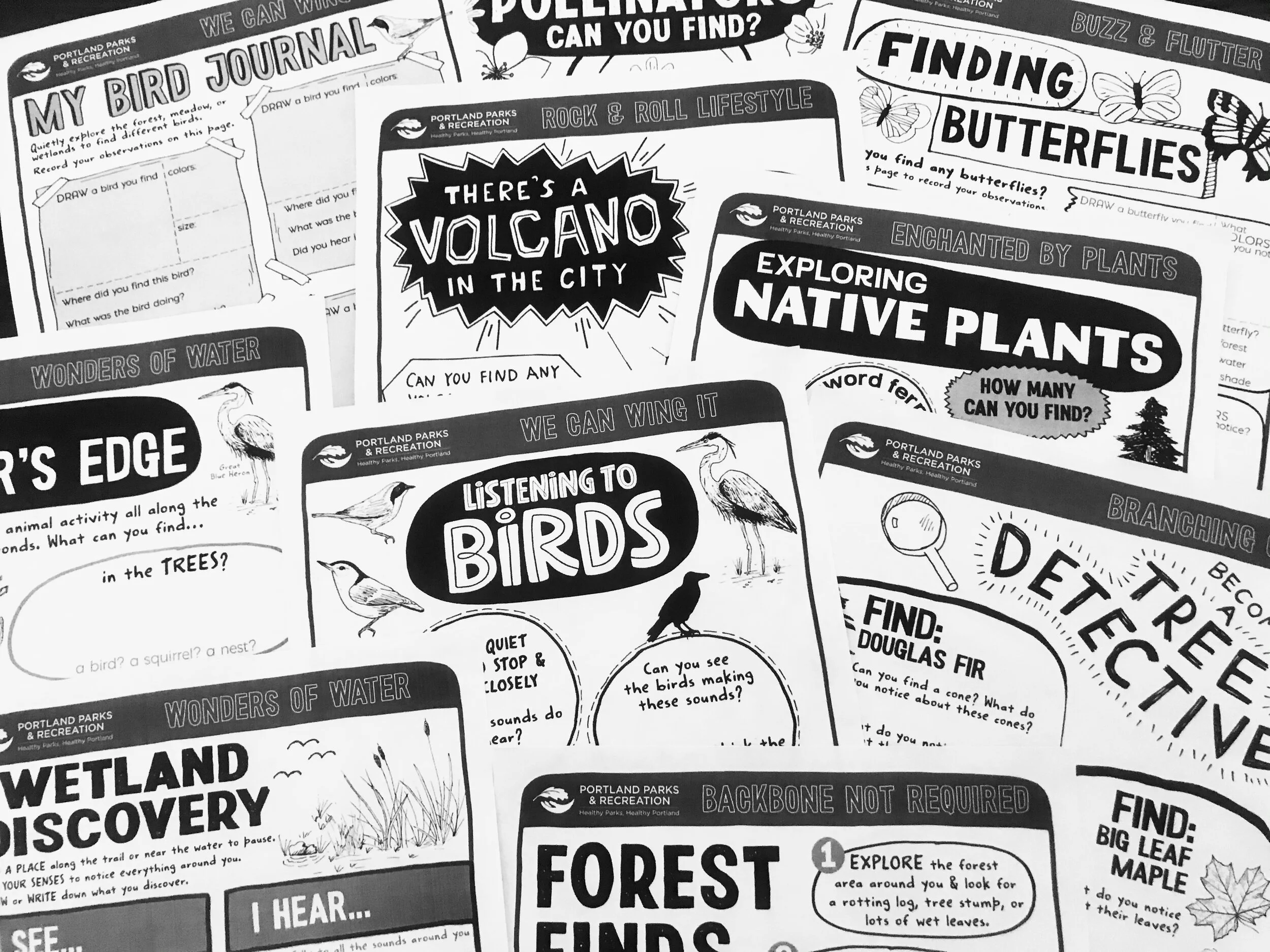
Portland Parks & Recreation: Summer Nature Camp Activity Sheets
The Summer Camp Kids Activity Sheets are a series of double-sided, place-based activity sheets created specifically younger elementary kids. They were commissioned by Portland Parks & Recreation for use by camp counselors in Portland Parks & Recreation Summer Nature Camp Programming, beginning in 2021.
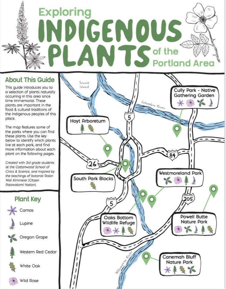
Exploring Indigenous Plants with Cottonwood School
Learn about the Indigenous Plants map we created with the Cottonwood School of Civics and Science as part of a school learning partnership. This consulting and design project included classroom workshops with the students on map making and botanical drawing, and was supported by additional lessons and guidance about content and plant selections by Indigenous educators.
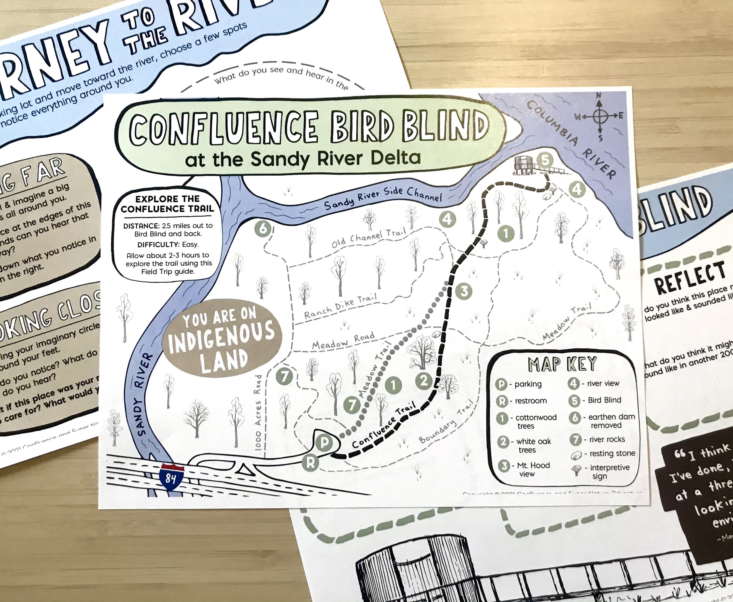
Field Guide: Confluence Bird Blind at Sandy River Delta
The family-centered Field Guide for the Confluence Bird Blind at the Sandy River Delta is a project completed for Confluence, a nonprofit with the mission of connecting you to the history, living cultures, and ecology of the Columbia River system through Indigenous voices. It is one of a series of several projects designed for hands on learning through engagement with Confluence art sites.
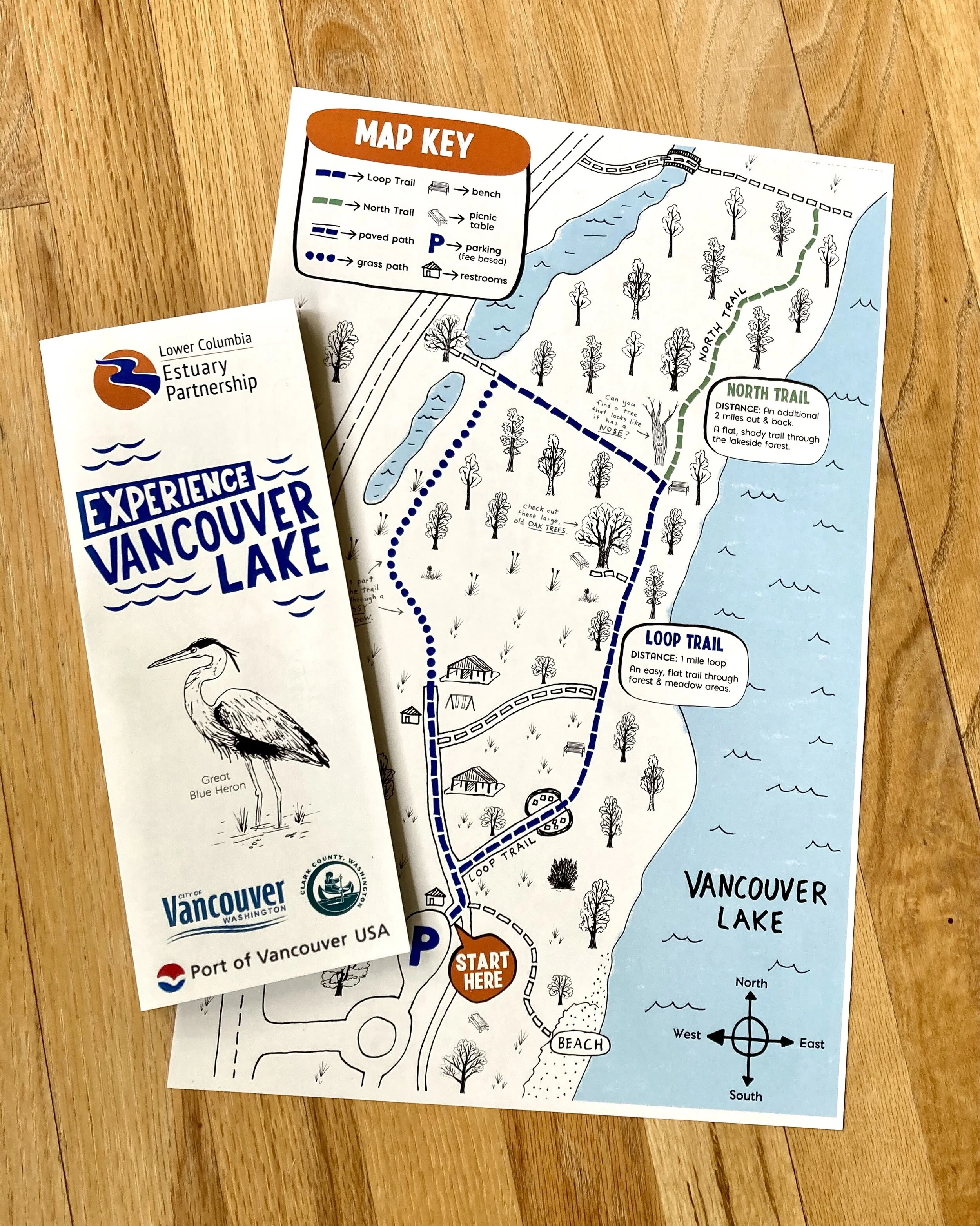
Lower Columbia Estuary Partnership: Experience Vancouver Lake Map
The “Experience Vancouver Lake” Map was commissioned by the Lower Columbia Estuary Partnership, a Vancouver, Washington, based non-profit organization dedicated to protecting the Columbia River basin and educating the community, as part of the educational programs there, in partnership with Clark County, the City of Vancouver, and the Port of Vancouver. The map is part of the "Experience Vancouver Lake" campaign, which encourages Vancouver area students, families, and community members through programs that build awareness and appreciation for Vancouver Lake.
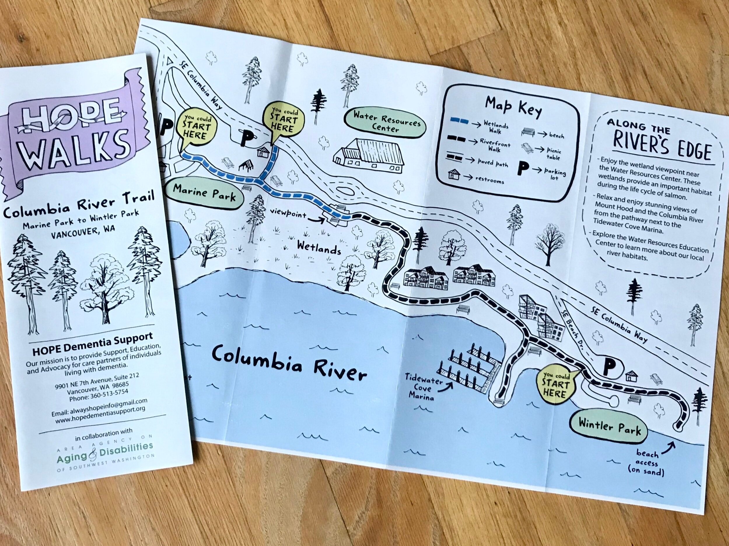
HOPE Walks Trail Maps: Columbia River Walk
Learn more about the Columbia River Walk Map, part of the HOPE Walks Trail Maps series, a set of maps commissioned by Hope Dementia Support in partnership with the Area Agency on Aging & Disabilities of Southwest Washington for public use, with a special focus on aging populations, including those with dementia and those who care for them.
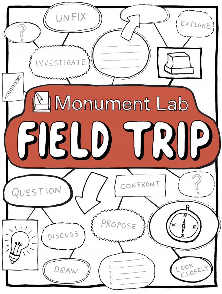
Monument Lab Field Trip: Monuments
Introducing the Monument Lab Field Trip, a 10-page hands-on activity guide created in partnership with Philadelphia based public art and history studio, Monument Lab, as a tool to explore, engage with, question, and examine public monuments.
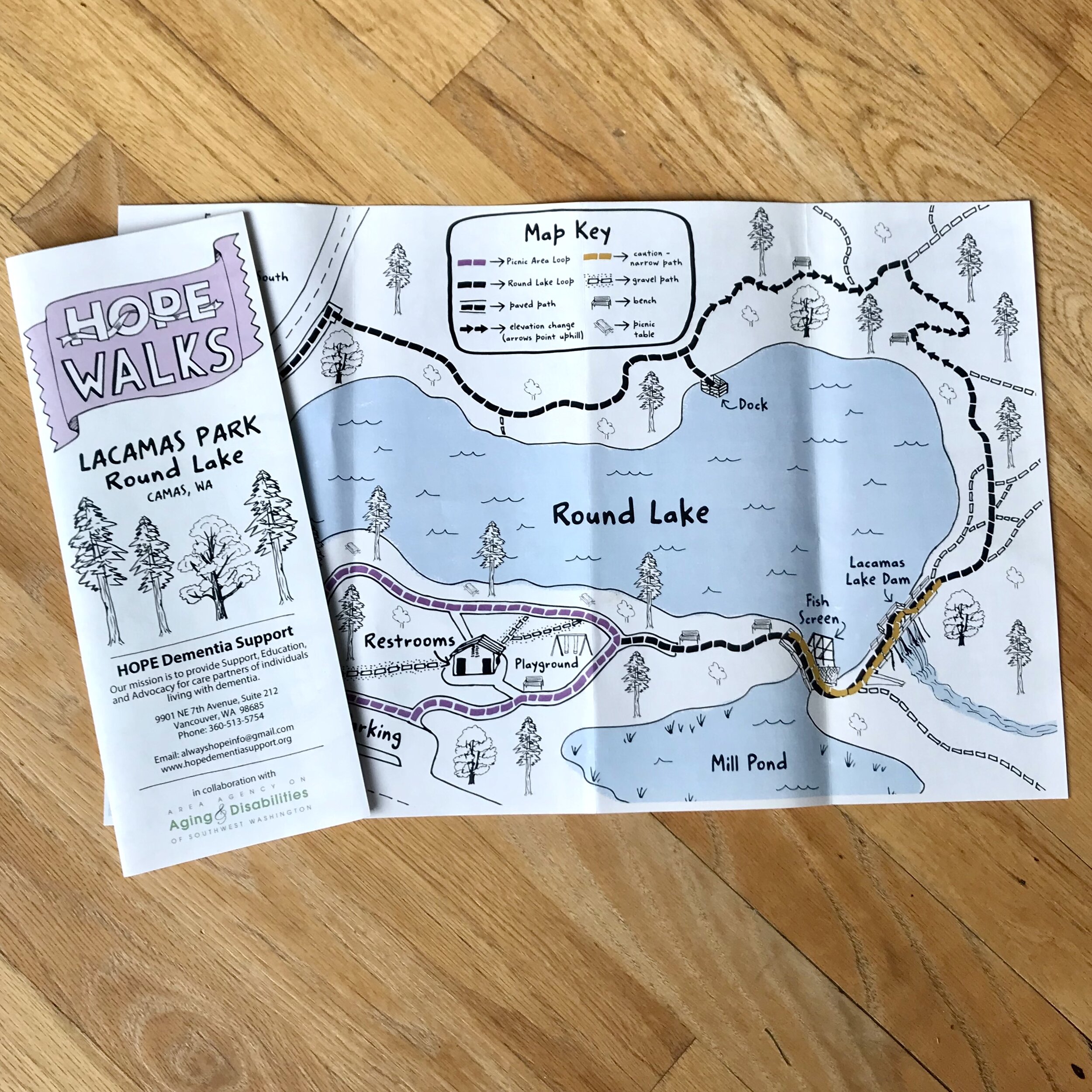
HOPE Walks Trail Maps: Lacamas Park
Learn more about the Lacamas Park Map, part of the HOPE Walks Trail Maps series, a set of maps commissioned by Hope Dementia Support in partnership with the Area Agency on Aging & Disabilities of Southwest Washington for public use, with a special focus on aging populations, including those with dementia and those who care for them.
Hoyt Arboretum Children Adventures Map
Introducing the Hoyt Arboretum Children’s Adventures Map, designed for Hoyt Arboretum in Portland, Oregon, as their public use, family-focused map.
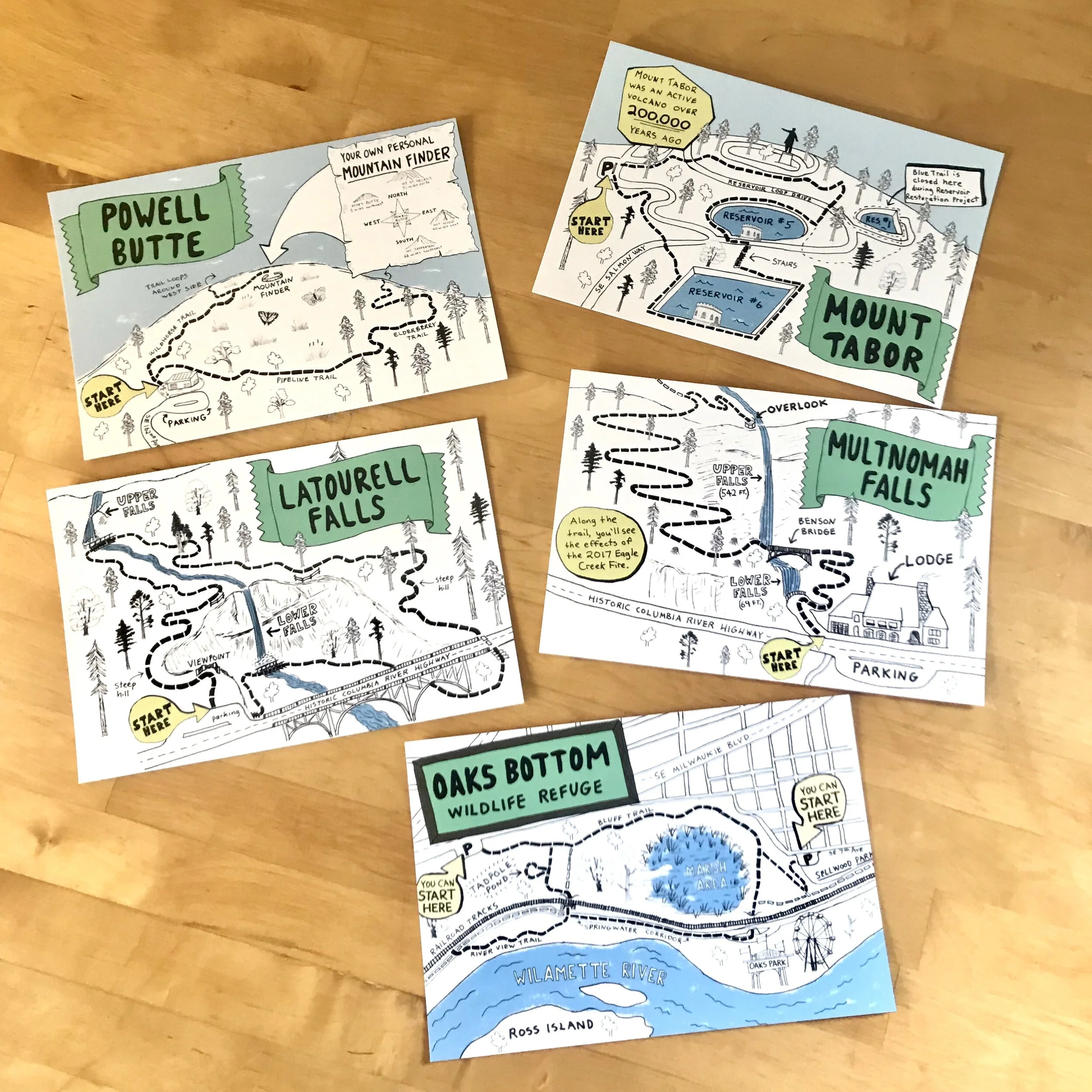
Mahaffy Real Estate: Trail Illustration Postcard Series
The Trail Map Postcard series was a monthly illustration series designed for Mahaffy Real Estate Group as part of their 2019 marketing campaign. The project featured 12 different popular trails in the Portland region, each illustrated in a hybrid map and illustration style to capture the essence of what makes each particular trail unique. The illustration series was published on postcards and in a calendar at the end of the year.