HOPE Walks Trail Maps: Ridgefield National Wildlife Refuge

Introducing the Ridgefield National Wildlife Refuge Map, part of the HOPE Walks Trail Maps series, a set of activity-centered maps commissioned by Hope Dementia Support, in partnership with the Area Agency on Aging & Disabilities of Southwest Washington for public use, with a special focus on aging populations, including those with dementia and those who care for them.
Studies have been shown that time outdoors has a positive health impact on individuals with dementia as with all populations. These maps are designed as a resource focusing on accessible nature trails, with this broader health focus in mind.
As Hope Dementia Support Vice President Julie Donovan explains in an article in the Reflector on the project: “It’s about enabling people to be outside and creating more peace-of-mind safety around that.”
Some key features of the Ridgefield National Wildlife Refuge Map include:
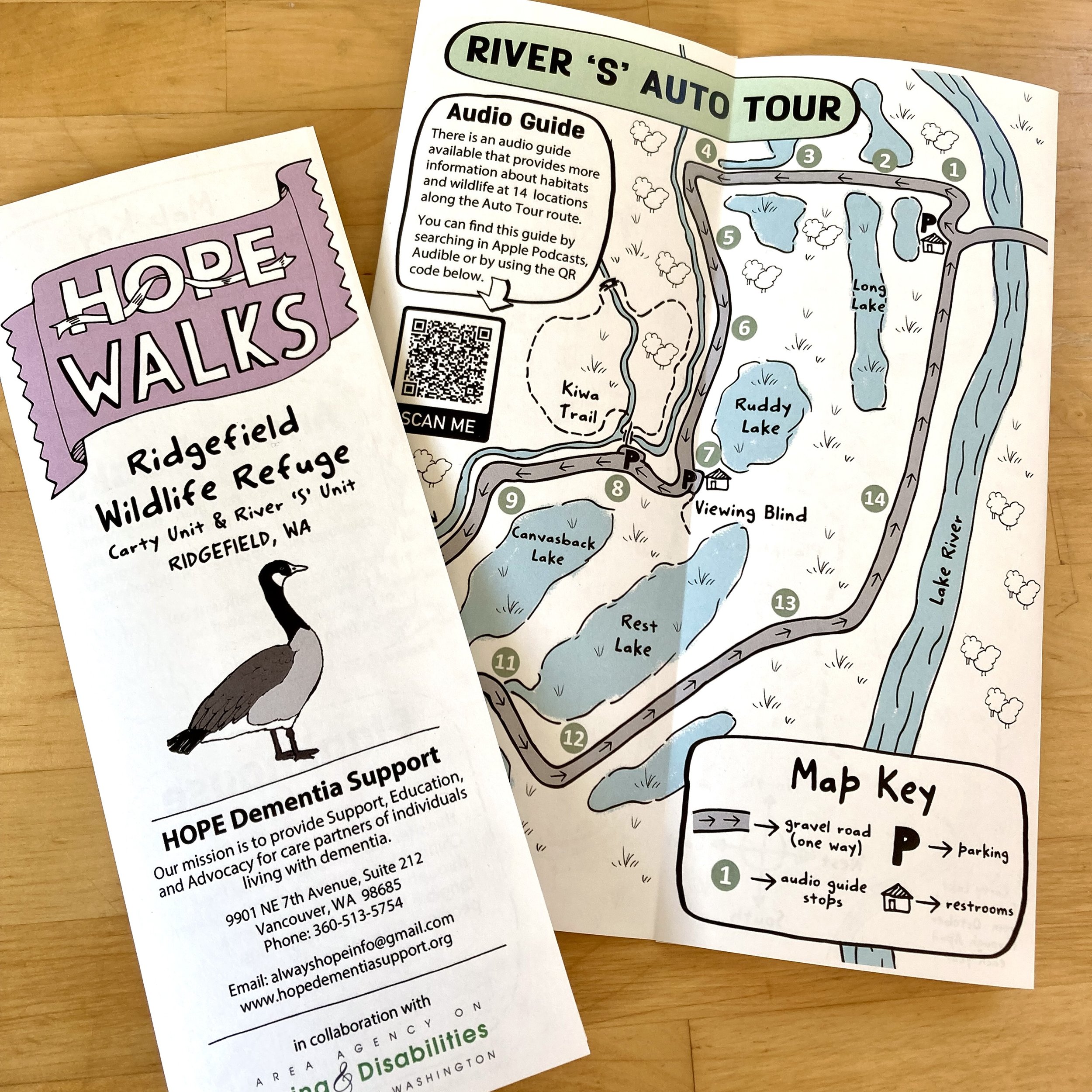
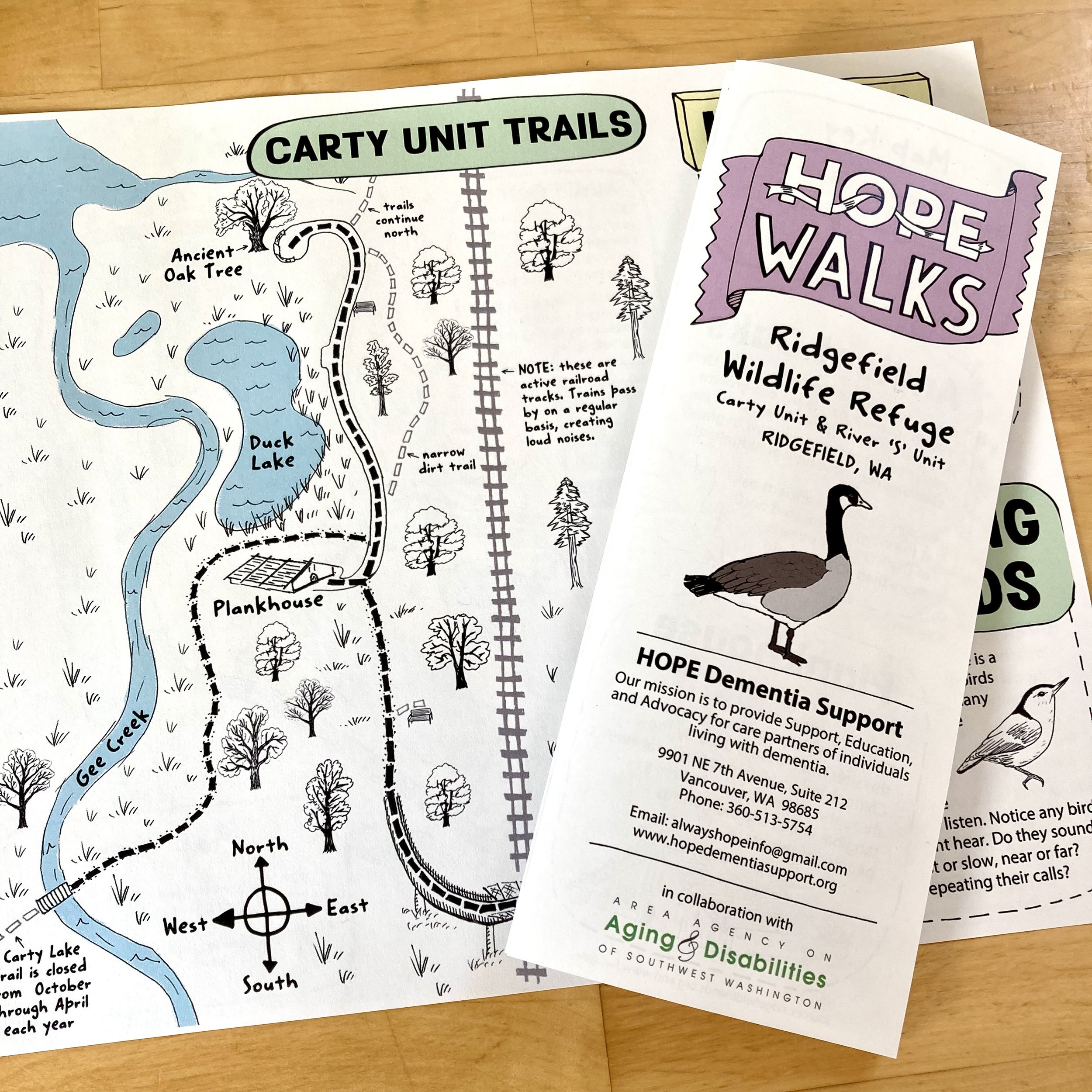
Two parts of the Ridgefield National Wildlife Refuge:
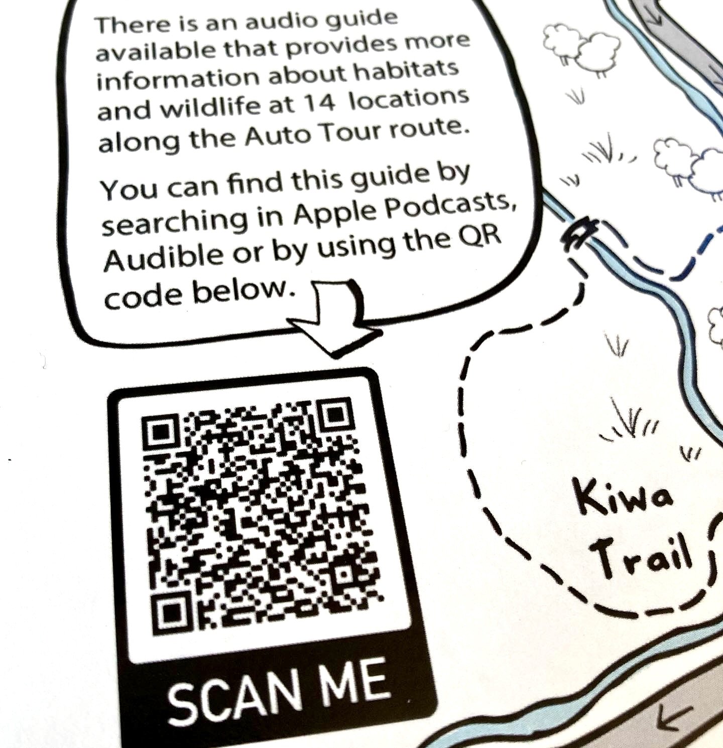
(1) The ‘River S Unit’ side features an auto tour route and podcast audio guide about the area’s wetland wildlife that can be accessed through a barcode created for the map
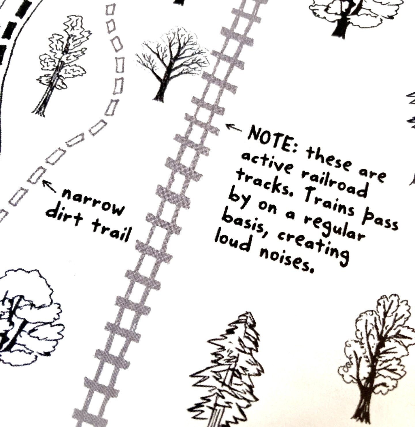
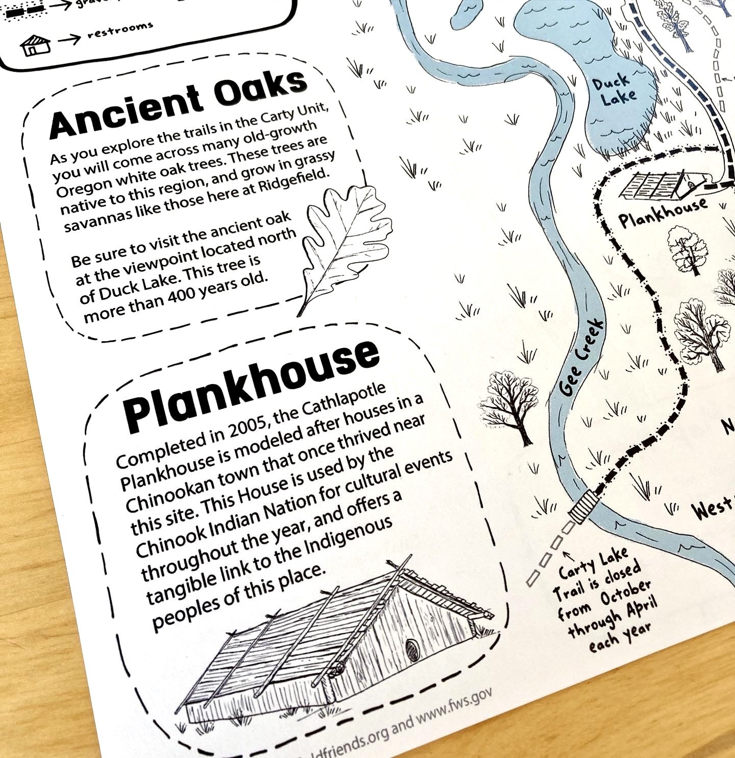
and (2) The ‘Carty Unit’ side feature san accessible trail route with stops by a Chinook Plankhouse and 400+ year old white oak trees.
A focus on the proximity of bathrooms, accessibility for wheelchairs or walkers, loud noises from trains, and the inclusion of sensory activities
Design focus on clarity and legibility, with activities that are multi-generational in nature for family hikes and drives
Project Credits
This project was commissioned by HOPE Dementia Support, a Vancouver area non-profit program with the mission of support, education, and advocacy, to individuals caring for those with all kinds of dementia. To learn more about the HOPE Dementia Support mission, programming, and resources, visit here.
This series has been created in partnership with the Area Agency on Aging & Disabilities of Southwest Washington. A team that has included community park volunteers has worked with us during content planning meetings on these maps to select trails with natural beauty and accessible features. Each map was designed with the needs of aging populations and individuals with dementia in mind, using a larger font and clear graphics to delineate the features. Each map also includes activities on the reverse side focusing on sensory experiences, designed for multigenerational use.
Other maps in this series include the Columbia Springs Map (found here), the Lacamas Park Map (found here), and the Columbia River Walk Map (found here).
Learn more about how to get a copy of any of these maps, by visiting the HOPE Dementia Support programming page.